Badlands National Park

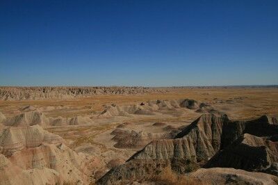
One of the things I love most about many of the National Parks is their rugged beauty and that is exactly why I can’t wait to visit Badlands National Park in the near future. One photo (this one courtesy of wormwould) shows that Badlands could be the poster park for the “rugged beauty” title:

scenic view of Badlands National Park

I am also intrigued by Badlands National Park because it contains one of the world’s richest fossil beds and the terrain has yielded the bones of many ancient mammals such as the rhinos, horses, and saber-toothed cats. For those not convinced by the above, the following video should erase all doubt (it did for me) that I definitely need to visit Badlands National Park at the next opportunity:

Wind Caves Mount Diablo California State Park

When you enter the Rock City area of Mount Diablo California state park, you can find a small parking lot towards the top that places your next to Wind Caves. This is an area where sandstone rock has been eroded away leaving large pocket holes in the stone:
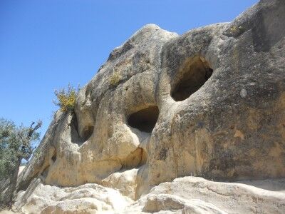
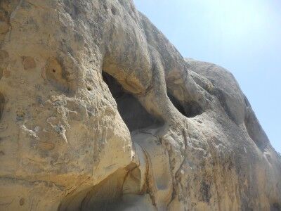
Wind Caves at Mount Diablo California State Park

The Wind Caves at Mt. Diablo State Park

Although the name “Wind Caves” gives the impression that the wind has formed these hole ridden rocks, an information sign gives a better explanation of the process:

Erosion Creates Dramatic Rock Sculptures

Along the trail here in Rock City, you will see dramatic caves sculptured in the sandstone. Though commonly called “Wind Caves,” these cavities have a more complex origin.

These cavities began to form when the sandstone once buried far below the Earth’s surface was exposed in recent geological time during the uplift of Mt. Diablo. Rain, mixed with carbon dioxide from the air, formed weak acidic water that ran over and into the rock. It dissolved the calcite cement that acts as a “glue” holding the sand grains together. Each summer, heat drew water out of the rock and, over the centuries, evaporation left a hard carbonate crust on the surface.

Here and there, the crust cracked and fell away exposing the weakly cemented sandstone inside. The softer material eroded more quickly than the crust, leaving behind the cavities. This sculpturing process continues today.

These are fun to look at and explore (although they have unfortunately been covered in graffiti). One discovery that you will make is that plants have been able to eek out an existence in the most unlikely of places amount the sandstone formations:
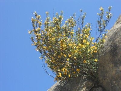
Flowering plant growing out of Wind Caves at Mt. Diablo state park

For those not satisfied with seeing the formations from the bottom, it’s also possible to make it to the top using a series of footsteps that have been worn into the sandstone:
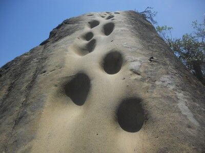
steps that lead to the top of Wind Caves at Mt. Diablo state park

It’s definitely a fun place to take photos and explore for an afternoon. For more information on how you can help protect and preserve this state park, you can get information at Save Mount Diablo or on their facebooke page
The Arches of Arches National Park

Although I have been to a lot of National Parks in the west, one that I have not yet been to is Arches National Park. Hopefully that will no longer be the case by the end of this year. I am planning a trip this September that should allow me to spend a few days there, and while I was doing a bit of research on it, I came across this video showing many of the arches and landmarks to be seen there:

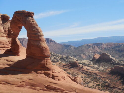
For anyone still not convinced that Arches National Park is worth a visit, take a look at this absolutely stunning set of Arches photos taken by james.gordon6108. Here is just one of them to wet your appetite:

Delicate Arch at Arches National Park

I can’t even tell you how excited I am to see this National Park.

Yucca Creek Crystal Cave Sequoia National Park

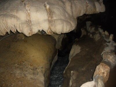
The water that flows through Crystal Cave in Sequoia National Park (CA) is Yucca Creek which flows into Cascade Creek. As soon as you move into the entrance of Crystal Cave and pass through the spiderweb gate, you can here the gurgling of Yucca Creek as it passes through the cave:

Yucca Creek in Crystal Cave Sequoia National Park

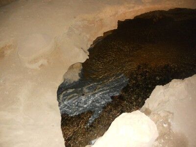
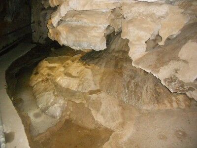
Yucca Creek also reveals that Crystal Cave is a rare marble cave (only about 5% of the caves in the world are marble caves) like at Oregon Caves National Monument and the river bed reveals the marble of Crystal Cave:

Marble exposed in Yucca Creek Crystal Cave

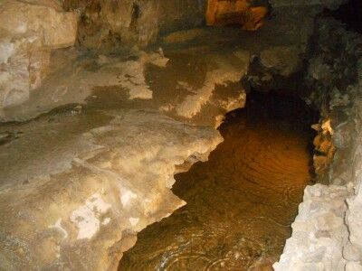
Yucca Creek is evident well into the cave even after passing Emerald Pools:

Yucca Creek in cave

Precipice Trail Acadia National Park

Precipice Trail at Acadia National Park is not your average hiking trail. If you are looking to do something a bit more adventurous (and you’re not afraid of heights), this would be one of the National Parks trails to put on your list. Precipice Trail has a nearly 1,000 foot vertical climb in less than a mile which entails bouldering, using rungs & ladders and making your way across narrow exposed ledges with steep drop-offs. You know you are getting yourself into something a bit more strenuous than a regular hike when the sign at the Precipice Trail reads:

Caution. The Precipice is maintained as a non-technical climbing route, not a hiking trail. Attempt this route only if you are physically fit, wearing proper footwear, and have experience in climbing near exposed cliffs and heights. Allow three hours for a round-trip climb. Avoid this route during inclement weather or darkness. Stay on the trail and do not throw or dislodge rocks onto hikers below. Persons have received serious injuries and others have died on this mountainside!

You will see how true this is with the video below (it will get your heart beat up just watching)

As the video and warning sign make clear, you definitely want to check the weather forecast before attempting to climb Precipice Trail. It’s also pretty obvious that you need proper footwear as non sturdy hiking shoes would not only make the climb uncomfortable, it would also make it quite dangerous. This is also a hike that looks to be much safer with a partner than alone.

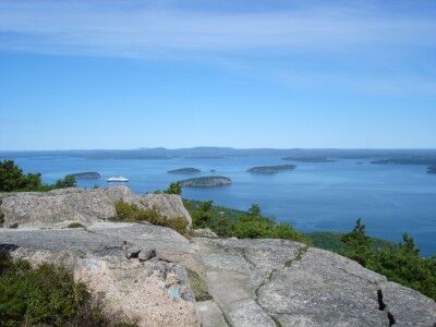
Precipice Trail is definitely on my “to do” list when I manage to get to Acadia National Park. Be sure to check whether or not Precipice Trail is open because it does close temporarily during peregrine falcon nesting season from March 15 – August 15 (Precipice Trail may be opened earlier if the peregrine falcons are not nesting on the cliff, as determined by the park wildlife biologist). While the trail looks like a challenge, the reward is a beautiful view (photo courtesy of scudsone)

The view from the summit of Precipice Trail at Acadia National Park

and a climbing story that you will surely enjoy telling to your friends and family.

Zion National Park Drop-In Volunteer Program

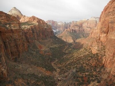
Zion National Park will begin offering its weekly drop-in volunteer program tomorrow, June 10, 2011 and will continue every Friday through the end of November. Volunteers are the unsung heroes of National Parks. If you love visiting National Parks, consider volunteering to help out in any way that you can.

View of Zion National Park

The Zion National Park drop-in volunteer program is open to all. Anyone visiting Zion, as well as local residents, will have the opportunity to help with the many projects which help keep the park clean and beautiful. It’s a wonderful way to show your support for and to help preserve Zion National Park.

Those that are interested in volunteering should gather at the Zion Canyon Visitor Center Shuttle Stop at 9:00 a.m. each Friday. The volunteer projects will last approximately two to three hours and do not require prior knowledge or training. Examples of volunteer projects would include litter removal, minor trail maintenance, and the management of invasive plants. If you decide to volunteer, be sure to bring water, a hat, sunscreen and good walking shoes. You do not need to bring tools. Both gloves and tools will be supplied if necessary.

Everyone is welcome to participate in the Zion drop-in volunteer program. There is no registration required for individuals — just show up on time. For groups larger than 10 people who would like to volunteer, you do need to pre-register. Minors under the age of 18 must be joined by an adult. For any questions, more information or to pre-register a group, contact the Zion volunteer coordinator at 435-772-0184.

You may also be interested in other Zion Volunteer Programs

Agate House Petrified Forest National Park

When you live in an area that has limited building materials, you use those materials that are around. That is exactly what the Pueblo Indians did when they built Agate House out of petrified wood blocks. Located on top of a small hill within the Rainbow Forest at Petrified Forest National Park, the original house was eight rooms with the petrified wood blocks laid in a clay mortar. Agate House was partially reconstructed in the 1930s.

To get to Agate House, you can take the Agate House Trail which has its trail head across the street from the Rainbow Forest Museum parking lot and down about 100 feet on the main road. The trail is approximately 1 mile long. You used to be able to drive closer, but the road has been closed and is now sprouting weeds and other vegetation. There is a shade shelter about half way along Agate House Trail, but otherwise there isn’t much sun protection.

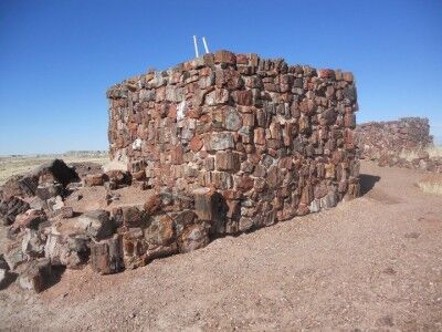
While there are only a few rooms still left at Agate House, it’s an amazing structure to walk around:

Agate House at Petrified Forest National Park

Petrified wood house at Petrified Forest National Park

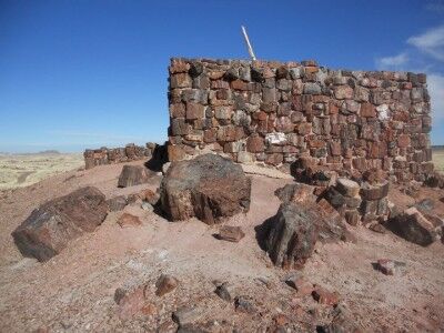
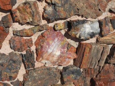
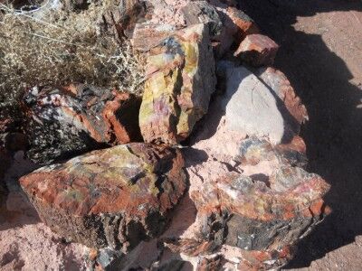
It’s especially fun to look at the amazing colors in the petrified wood that was used to build Agate House:

Petrified wood used in building Agate House at Petrified Forest National Park

Petrified wood used to build Agate House at Petrified Forest National Park

Zion National Park Photo Contest 2011

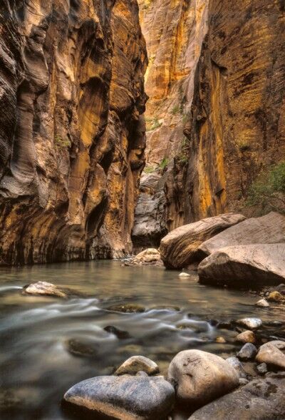
If you happen to be travelling to Zion National Park this month (or travelled there earlier this year), don’t forget to submit any photos you took to the Zion National Park photo contest. The 2010 winner was Virgin River Narrows by David Lenhert:

Virgina Rivers Narrows at Zion National Park 2010 Photo winner

The 2011 Zion National Park photo contest is open to amateur photographers with the photos being judged by what “will make us and others want to visit Zion National Park.” The deadline for submitting photos is July 4, 2011. All entries must be print photos with both black and white and color photos acceptable (no photos on disc or through email will be accepted). It’s important to remember to write your name, address and email on the back of each photo submitted. There is no limit to the number of entries as you can submit. Winning photos will be announced on or before July 24, 2011. Photos should be mailed to:

East Zion Tourism Council
Photo Contest
East Zion
Mount Carmel, UT 84755

For more information on this contest, you can visit the photo contest page of the East Zion Tourism Council.

Point Reyes Lighthouse

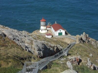
Once you make your way past the Point Reyes Lighthouse visitors center, the gray whale skull and the water collection system at Point Reyes National Seashore, you’ll round the corner and get your first glimpse of the Point Reyes Lighthouse. There is an observation deck that looks down upon the lighthouse and you’ll immediately understand why so many people love to come out to see it:

Point Reyes Lighthouse from observation deck

Warning to all: The Point Reyes Lighthouse is not open on Tuesday or Wednesday. Even on the days that it is closed, you can still view the lighthouse from the observation deck, but you will not be able to descend the stairs to the lighthouse to see it up close and personal. The lighthouse stairs, the exhibits in the lower lighthouse chamber, and the equipment building are open Thursday through Monday from 10:00 a.m. to 4:30 p.m. (stairs to go down to the lighthouse close at 4:00 p.m.) weather permitting. Point Reyes is the windiest area on the Pacific coast and even on clear days, the stairs will sometimes be closed due to high winds. The light house lens room where the Fresnel lens and clockwork mechanism are located is open Thursday through Monday from 2:30 p.m. to 4:00 p.m.

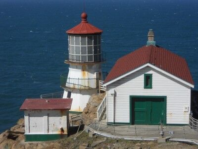
Point Reyes Lighthouse close-up Point Reyes National Seashore