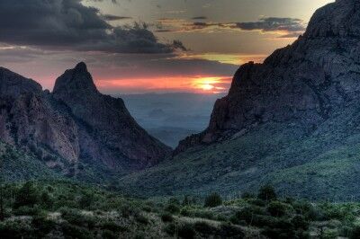
Gold Bluffs Beach Redwood National Park

When you think of Redwood National Park, the first image that comes to mind usually isn’t the beach. That’s a shame because there are some beautiful beaches which are part of the Redwood National and State Parks. Gold Bluffs Beach is one of these.

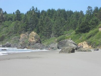
Located in Prairie Creek Redwoods State Park (CA), you need to turn off highway 101 onto Davison Road at Elk Meadow (There is a large sign for Elk Meadow overlook — when you reach the Elk Meadow overlook, continue straight onto the dirt road). Davison Road winds its way through beautiful redwood groves until it reaches the sea. Once you hit the shoreline, you leave Redwood National Park and enter Prairie Creek Redwoods State Park (there is a state park fee to enter). While most people head to Fern Canyon and bypass the beach all together, this is a mistake. The beach is vast with very few people (because they are all heading to see the redwoods) making it a perfect place to take a long stroll in near solitude:
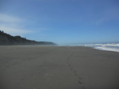
Gold Bluffs Beach in Redwood National Park

For those who don’t feel like walking, there are plenty of ocean-worn rocks littering the beach to look at and admire:
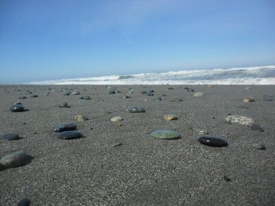
Rocks in sand at Gold Bluffs Beach in Redwoods National Park

And for those with a little bit of ambition, the rocks are perfectly shaped to have some fun stacking them:
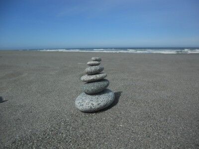
Stacking rocks at Gold Bluffs Beach Prairie Creek Redwoods state park California

While the redwoods are obviously the main attraction at Redwood National Park, try to take some time to visit the beach as well. You won’t regret it.
Sulphur Works Lassen Volcanic National Park

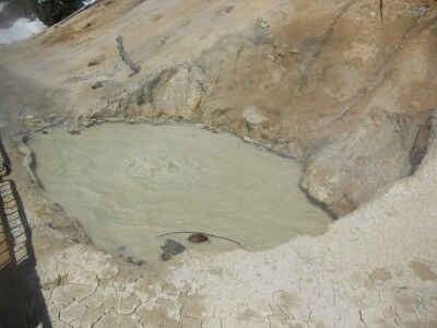
While there wasn’t a lot open due to the large amount of snow still on the ground in mid June at Lassen Volcanic National Park, one area that was accessible to visitors was Sulphur Works. You could immediately tell that this part of the park was active due to the “rotten egg” sulphur smell that was apparent even all the way down at the visitors center. The main attraction was a large pool of boiling, bubbling brown water:

brown bubbling water at Sulphur Works in Lassen Volcanic National Park

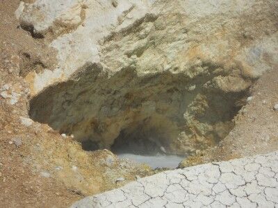
Just above the brown boiling water pool was another cavity where both boiling water and steam were escaping:

steam and boiling water at Sulphur Works in Lassen Volcanic National Park

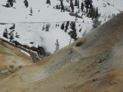
Several active steam vents could be found across the street on a hillside which was notable due to it being the only one void of any snow:

Steam rising from the ground at Sulphur Works in Lassen Volcanic National Park

While not the most picturesque example of volcanic activity, Sulphur Works was worth stopping at to get a taste of what might be found at the currently inaccessible volcanic activity areas in the park. It was a nice preview which makes me want to come back when the trails are clear of snow so I can explore the other hotbeds of volcanic activity within the park.

Trinidad State Beach California

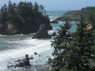
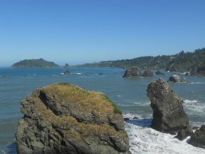
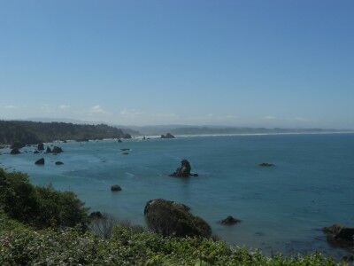
While Trinidad state beach is a bit difficult to find (once you exit and head into the town of Trinidad, the main road will first curve 90 degrees right and then a little later 90 degrees left — toward the coastline. Instead of following the main road and turning left, you want to make another right down a one lane road to find the entrance to Trinidad state beach). Once you reach the parking area, there are a lot of picnic tables and a wonderful view of the beach below. The many rock outcroppings in the ocean making them part of the California Coast National Monument:

The view overlooking the beach at Trinidad State beach in California

It is a about a quarter mile hike down to Trinidad state beach along a narrow dirt path.

beach level at Trinidad state beach in northern California

It was extremely windy while I was there making the view and picnic are much more comfortable than the beach (there were trees that blocked the wind up there), but I don’t know if that is a regular occurrence or not. It was a fun beach to explore with all the different rock outcroppings.

California Coastal National Monument

I’ve looked at one of our National Monuments hundreds of times and never even realised it. If you have ever been along the California coast, there is a good chance that you have seen this national monument as well. The California Coastal National Monument, as it name implies, spans the entire coast of California and was established on January 11, 2000. It compromises more than 20,000 small islands, rocks, exposed reefs and pinnacles located off the 1,100 miles of the California coastline.

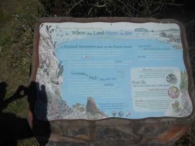
I would not have even realised I was enjoying the scenery that this National Monument provided except for an informational sign I happened across:

A California Coastal National Monument sign found overlooking Trinidad Bay

Where Land Meets The Sea

A National Monument here on the North Coast?

Scan the coastal landscape spreading out before you. This area is rich in geological history and biological resources. The rocks dotting Trinidad Bay are now part of California Coastal National Monument (CCNM).

The Bureau of Land Management manages the CCNM, a network of over 20,000 small islands, exposed reefs, rocks and pinnacles spanning California’s entire 1100 mile coastline.

Landslides melting into the sea

Large masses of land are continually slumping into the ocean. The slow moving landslides, or earth flows, are a mixture of sediments from soft clay to hard rock. Like Rocky Road ice cream left in the hot sun, wave energy melts the softer sediments away, leaving behind large, chunky rocks. Many of the rocks you see close to shore were deposited from earth flows.

Ses Stacks: Hard rocks of the old coast

Some of the rocks that you see were once part of the ancient coastline. These resistant formations, or sea stacks, were isolated by rising seas, you erosive surf and geological uplift. Pilot rock is one example.

Trinidad Bay California seen from Luffenholtz Creek

all rock formations off the coast of California are part of the California Coastal National Monument

So now you know. If you happen to be along the California coastline and see rock formations off the coast, you are looking at one of our newer National Monuments.

Unusual National Parks Vehicles

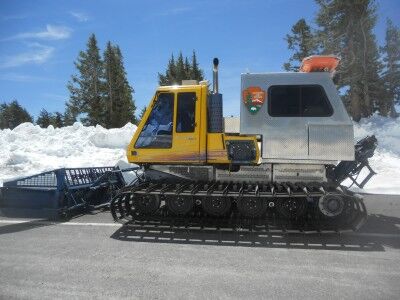
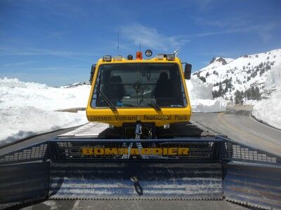
As I took my hike up to where they were removing snow in mid June on the road at Lassen Volcanic National Park, I came across a National Parks snowplow:

National parks snowplow at Lassen Volcanic National Park

National Parks Service snowplow at Lassen Volcanic National Park

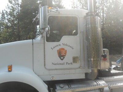
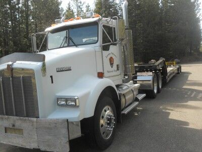
This caught my eye because when I was entering the park, I also saw a National Parks big rig 18 wheel truck:

18 wheel big rig truck for Lassen Volcanic National Park

National Park service big rig for Lassen Volcanic National Park

This got me thinking that with National Parks in the mountains to the sea and everything in between, there must be some pretty unusual vehicles owned by the National Parks service. If you have come across some unusual vehicles owned and operated by the National Park service on your travels, let me know about them (or even better, send me a photo so I can share them with everyone). I bet we can gather a pretty interesting collection.

Lassen Volcanic National Park Struggling With Snow

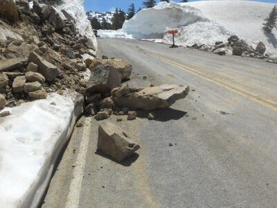
Like many of the mountain national parks, Lassen Volcanic National Park is struggling with the large amount of snow it received this year. I visited the park yesterday and most of it is still closed due to snow. From the Southwest entrance, the road is only open for about half a mile to the Sulphur Works area and all hiking paths on that side of the mountain are still covered in snow pack (you need snowshoes or cross country skis). The road is clear up to the Bumpass Hell parking area, but the park isn’t allowing cars up there yet because snow removal crews are still working and they are having some issue with rock slides as the snow melts:

rocks fall onto the road at Lassen Volcanic national Park

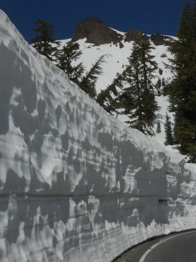
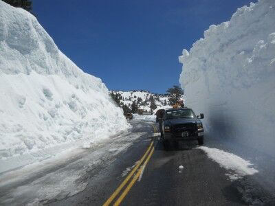
Even though the road was closed to cars, I decided to hike up to where they were clearing snow. It was about a 2.5 mile hike along the road without anyone else around (Protip: If you enjoy biking, it would be the perfect time to bike the closed road). As the road wound its way upward, the snowbanks on the side of the road increased, reaching as high as 20 feet in some spots:

Snow wall on side of road at Lassen Volcanic National Park

Truck next to snowbank at Lassen Volcanic National Park

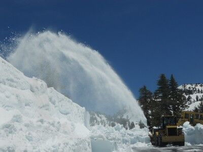
When I reached the area where they were removing snow, there were 6 snowplows working feverishly, yet making extremely slow headway due to the amount of snow on the road.

Clearing snow on the road at Lassen Volcanic National Park

I talked with a ranger who said the goal is to have the road open by July 1, but I’m not sure they are going to make it. They still have about 10 miles of road to clear that is buried under 15 feet of snow. Caltrans has stepped in and is now helping Lassen Volcanic National Park try to open the road (the snowplows that were working while I was there were Caltrans plows), but even with the additional help they still have a lot of work to do up there.

For those wanting to visit Lassen Volcanic National Park, there is a bit more open at the Manzanita Lake entrance. Hiking trails around Manzanita Lake (there were a lot of people on the lake fishing today) and Reflection Lake / Lily Pond are clear and the road is open for 10 miles to Devastated Area (although the Devastated Area loop hike was still covered in snow)

For those interested, more photos from the hike

Junction Room Crystal Cave Sequoia National Park

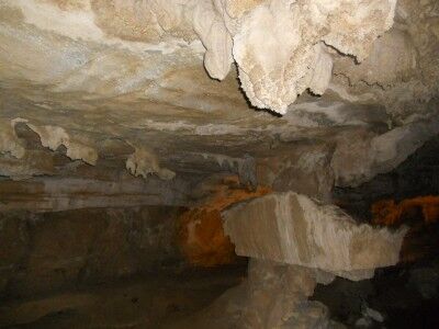
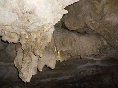
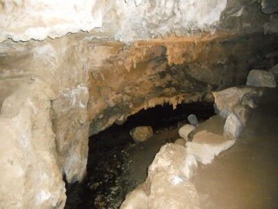
After passing Emerald Pools and continuing to follow Yucca Creek within Crystal Cave in Sequoia National Park (CA), you soon come to Junction Room. This is the first large room that you come to in Crystal Cave, and as the name indicates, is a junction room that you will eventually come back to during the tour of Crystal Cave. The room is distinctive from the large rectangular rock formation in the center of the room:

Junction Room in Crystal Cave at Sequoia National Park

In addition to being the junction area of the cave, Junction Room also has a nice display of soda straws and popcorn cave formations:

Junction Room in Crystal Cave

Yucca Creek also flows directly through Junction Room:

Yucca Creek flows through Junction Room in Crystal Cave

Point Reyes Lighthouse 308 Steps

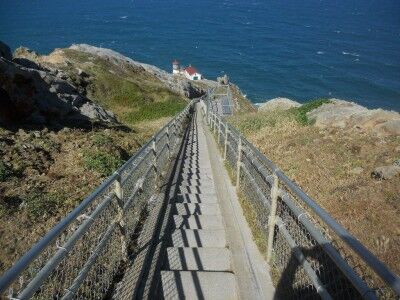
When you first see the Point Reyes Lighthouse from the observation deck at Point Reyes National Seashore (CA), your first instinct is to want to see the lighthouse up close. Then you take a look at these:

Steps going down to Point Reyes lighthouse

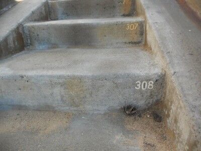
There is a sign that warns that the over 300 steps is the same as a 30 story building and while it’s easy to get down, you need to be in decent shape to make it back up. To help with the effort, there are three rest areas with a bench where you can stop to catch your breath on the way up. You begin the hike back to the top at step number 308:

Step 308 at Point Reyes Lighthouse

I consider myself to be in pretty decent shape and I was a bit winded by the time I reached the top. The key is to take it slow, rest when needed and give yourself plenty of time to make it back to the top. Even with the physically taxing climb, a visit to the lighthouse is well worth it.

Kayaking Biscayne National Park

I previously mentions that I would really like to see all National Parks eventually have virtual drives such as the Big Bend National Park virtual drive. The one thing I forgot to consider was that not all National Parks are necessarily on land. Such is the case with Biscayne National Park which is 95% water. So I tried to find the next best thing and what I came up with was a friendly kayak tour of part of Biscayne National Park bay (with some funky music to go along with it)

Of course, the real beauty of Biscayne National Park is found underwater on her coral reefs:

I am really looking forward to getting a chance to explore this National Park on land, by boat and underwater.

Big Bend National Park Virtual Drive

The first thing I do when I begin thinking about going to a specific National Park is to look at photos that people who have been to the park have taken. Robbie’s Photo Art had this gorgeous photo of a sunset when I was searching for photos of Big Bend National Park:

Sunset at Big Mend National Park

As I did some more searching, I came across a couple of videos that I’m pretty sure will replace what I look for first when thinking about going to a National Park. That is the virtual drive. There were two virtual drives available for Big Bend National Park:

This drive takes you up into the scenic center of Big Bend National Park, the Chisos Basin, then back down to the main road, before heading east to the Boquillas Canyon area.

This drive begins in the middle of the Ross Maxwell Scenic Drive, at the Chimneys trailhead, then heads north, east, and north again, until passing through Persimmon Gap and out the northern park entrance.

I don’t think that the virtual drive will replace the beauty of the photos, but I do think it gives a much better overall feel of the place you are thinking of going, and a more realistic view of the National Park. I would love to see these available for all National Parks and hope to see more National Park virtual drives available for viewing soon.