Limekiln Beach Limekiln State Park California

After hiking to Limekiln Falls and to the historic lime kilns, it’s also worthwhile visiting Limekiln State Beach at Limekiln State Park (CA). The beach is at the other end of the parking lot as the hiking trails (easily seen from the parking lot). You cross a small bridge over Limekiln Creek and enter the Limekiln beach campground. The Limekiln beach is at the far end of the campground just beyond a huge bridge that carries cars across the Limekiln Canyon on highway 1:
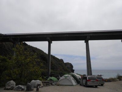
Limekiln beach campground at Limekiln State Beach California

Although it would seem that the beach would be quite noisy with the highway bridge right above, that is not really the case. The bridge is high enough that there is very little car noise on the beach. When I visited, someone has set up a small love seat directly next to one of the bridge support columns:
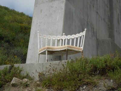
Loveseat at Limekiln State Beach

That provided a wonderful view of Limekiln Beach when sitting on it:
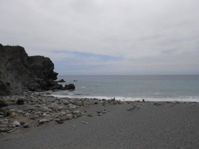
the view of Limekiln Beach from loveseat

Limekiln Beach itself is pretty interesting. On the left side, Limekiln Creek empties into the ocean bringing down a rocky bed of stones and boulders to the sea:
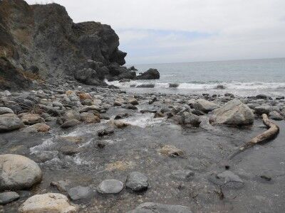
Limekiln Creek emptying into the ocean at Limekiln beach

To the right is a the beach, although it is littered with large stones that have been swept down the creek in the past:
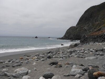
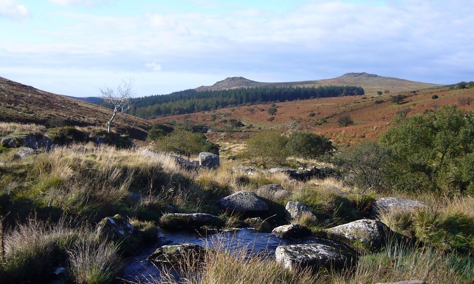
With the campgrounds nearby, there were plenty of kids and families enjoying the beach and the creek. I would imagine that it would be a wonderful place for families to camp giving everyone plenty of choices of how to spend the day depending on what they enjoyed doing most. If interested, here are some more photos of Limekiln State Park. Unfortunately, Limekiln State Park is on the list of California State parks to close.
Manzanita Tree Mount Diablo State Park California

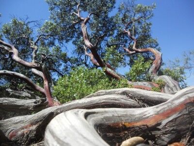
I am far from an expert photographer, but I do enjoy taking photos when I am wandering national and state parks. Every once in awhile I take a photo that I do like that seems to stand out from the rest. This is a photo I took at Mount Diablo State Park (CA) of a Manzanita tree.

Manzanita tree at Mount Diablo state park in California

There are plenty of Manzanita trees at Mount Diablo and the way that their trunks curve and twist allow you to get some fun and interesting photos of them. I think I could have probably spent an entire afternoon simply searching for cool looking Manzanita trees to photograph.

Turquoise Mineral Pools Little Colorado River Grand Canyon National Park Rafting

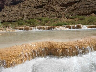
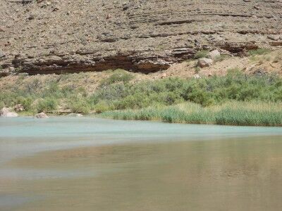
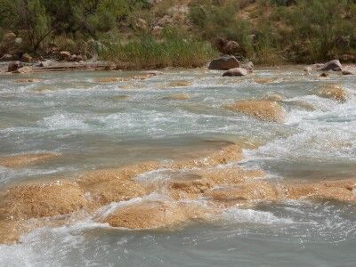
The Little Colorado River is a breathtaking turquoise color due to the alkaline and minerals content of the water. In addition to creating the wonderful color of the Little Colorado River, the minerals settle in the Little Colorado River channel to create pools which the river cascades over on its way down the canyon:

Pools made of minerals created in the Little Colorado River

Turquoise mineral pools at Little Colorado River

The turquoise waters of the Little Colorado River cascading over these mineral deposit pools makes it look like you have left Grand Canyon National Park and been teleported to some tropical paradise on the other side of the world. With the Little Colorado River’s water being much warmer than the Colorado River’s temperature (about 70 degrees versus 50 degrees), you can comfortably sit in any of the hundreds of mineral pools which have been created to relax and cool off from the hot Grand Canyon sun — something that I took full advantage of.

American Samoa National Park Photos

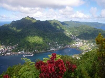
I’m hoping to make it to all the National Parks over the next few years. While I know about the vast majority of them, there are a few that I have no idea what they may look like. One of these is American Samoa National Park, but after seeing some of the photos taken at American Samoa, I can’t wait to eventually get there:

View from Mount Alava at American Samoa National Park:

view from Mount Alava
Courtesy of Naomi T

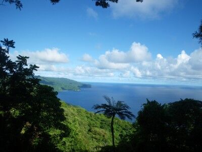
Palm Tree & Ocean View from Mt. Alava at American Samoa National Park:

Palm tree at American Samoa National Park
Courtesy of Naomi T

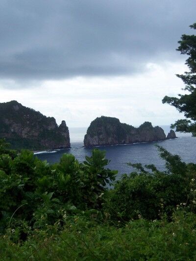
View of island from American Samoa National Park:

view of island from American Samoa National Park
Courtesy of benmiller23

If you have ever been to American Samoa National Park and have taken photos there, we’d love for you to share them (and your experience at the park) with us!

Acadia National Park Photos

One of the great things about the Internet is that even if you haven’t been to a particular National Park, you can do a little research and see the photos that others have taken at it. These are some photos that make me want to visit Acadia National Park all the more:

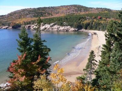
Sand Beach at Acadia National Park:

Acadia sand beach
Courtesy of Lee Coursey

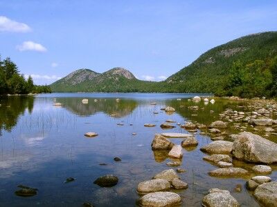
Jordan Pond at Acadia National Park:

Acadia Jordan Pond
Courtesy of kds4850

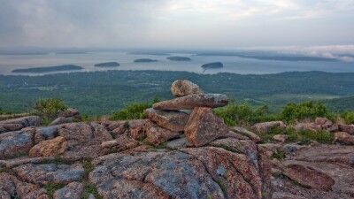
Blue Hill Overlook on Cadillac Mountain at Acadia National Park:

Blue Hill Overlook on Cadillac Mountain Acadia National Park
Courtesy of Gary Brownell

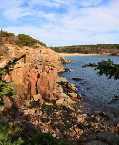
View from Park Loop Road at Acadia National Park:

Acadia national Park park loop road view
Courtesy of Dana Moos

Schoodic Peninsula tide pools at Acadia National Park:

Acadia Schoodic Peninsula tide pools
Courtesy of Dana Moos

If you have visited Acadia and have a particular photo that you particularly enjoy, we’d love for you to share it with us!

Lime Kilns Limekiln State Park California

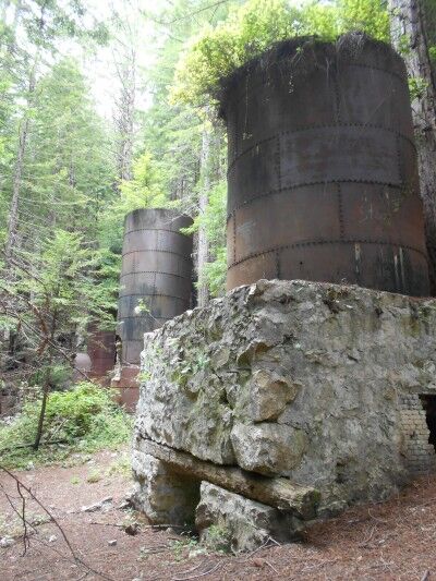
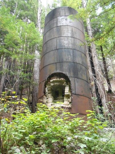
In addition to seeing Limekiln Falls at Limekiln State Park (CA), hiking to the historic lime kilns is also a must. It’s pretty strange seeing these huge iron and stone furnaces in the middle of a redwood forest where they look so completely out of place:

lime kilns at Limekiln State Park California

According to the Limekiln State Park brochure:

Beginning in 1887, the Rockland Lime and Lumber Company extracted, processed and exported thousands of barrels of lime from Limekiln Canyon. Four stone and iron furnaces were built at the base of a large talus slope eroding from the limestone deposit. Limestone rocks were loaded into the kilns, where very hot wood fires burned for long periods to purify lime.

The lime was packed into barrels, hauled by wagon to Rockland Landing on the coast and loaded onto ships that carried it to northern ports for use in concrete.

After only 3 years, the limestone deposit was depleted, as was the redwood forest that had been nearly clear-cut to use for lumber and fuel.

Today the four kilns, some stone walls and bridge abutments are the only remains of the thriving lime industry that existed here.

lime kilns in redwood forest

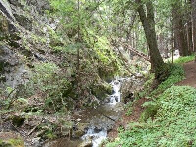
To get to the historic lime kilns, you follow the same directions as to Limekiln Falls, but take the fork to the left and remain on Limekiln Trail instead of right onto Falls Trail. The trail is quite easy without the obstacles that Falls Trail has, and the scenery is quite beautiful as you hike along West Fork Creek:

West Fork Creek Limekiln State Park California

If interested, here are some more photos of Limekiln State Park. Unfortunately, Limekiln State park is on the list of California State parks to close.
National Park Wilderness Photo Contest For National Park Service

If you have quality photos from your recent National Park trips, the National Park Service would love to take a look at them for possible inclusion for an upcoming wilderness section of Park Science. The beauty of the National Parks wilderness has inspired millions of people who have visited them, but it’s often difficult to capture the spirit of wilderness in words. The National Park Service is hoping to capture wilderness in photos to share in an upcoming issue of Park Science.

Photographers of the winning wilderness photos will receive full credit for their photo and their photo will be featured in a four-page color spread in the center of the Park Science edition. Winning photographers will also receive a handy item which can be used in the wilderness such as a trowel.

For those interested, you should attach up to three wilderness photos for consideration to Christina Mills at [email protected] in TIFF or JPG format by Friday, September 16, 2011. You should also include your name, where the photo was taken (what National Park System wilderness area), the date the photograph was taken and your contact information along with a short description of your thoughts when you took the photograph.

Photo Contest Rules

1. All photos must be digital.
2. All photos must be 3 MG in size or larger.
3. All photos must be in either TIFF or JPG format.
4. There is a submission limit of three photos per photographer.
5. Submitted photo must have been taken in a National Park System wilderness area.
6. Submitted photo must not have been retouched, optimized or had filters applied.
7. The photographer must license unrestricted use to the National Park Service if the submitted photo wasn’t taken on official National Park Service duty.
8. Photos should be emailed as an attachment to Christina Mills at [email protected]
9. Deadline for submission is Friday, September 16, 2011.
10. Please contact Christina Mills at (202) 513-7124 or email [email protected] with any additional questions.

Plaikni Falls Trail Crater Lake National Park

Crater Lake National Park has a new hiking trail that will officially be opening this Saturday (8/20/2011), but I had the fortunate chance to hike it today. It’s called Plaikni Falls Trail and it’s a wonderful change of beauty from what most people only see when they visit Crater Lake National Park — the lake. The Plaikni Falls Trail leads to a gorgeous “secret” waterfall and cascading river which, until recently, few people knew how to get to.

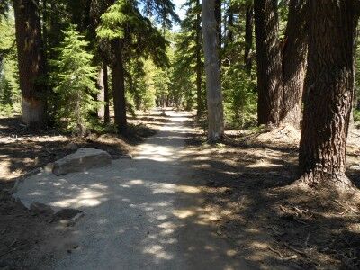
The trailhead is along Pinnacle Road, 1.2 miles southeast of the Phantom Ship overlook off of East Rim Drive. The trail begins with old growth fir and hemlock forest all around which provide a nice bit of shade:

Plaikni Falls Trail at Crater Lake National Park

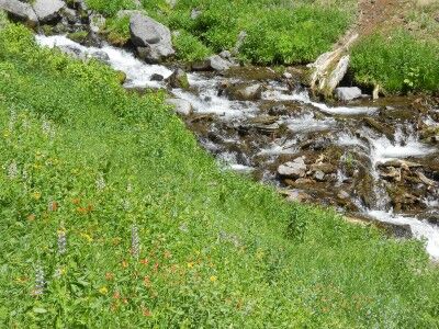
Plaikni Falls trail is a pleasant hike and relatively easy at 1.1 miles to the waterfall (2.2 miles round trip). The only real issue for most is that because it’s so short, it’s difficult to get away from other people if you’re looking for a bit of solitude — it can get congested. The trail travels through the trees and along rocky bluffs until it hits Sand Creek where it opens up to wildflowers and lush vegetation at the base of Plaikni Falls:

wildflowers at Plaikni Falls at Crater Lake National Park

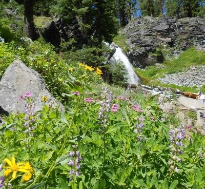
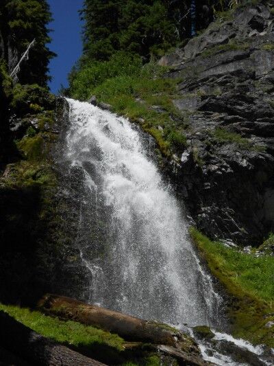
While Plaikni Falls isn’t grand in size, it’s quite beautiful as it comes down with abundant wildflowers (with butterflies fluttering all around while I was there — also mosquitoes, so you may want to spay on some bug spray before beginning the hike) and other vegetation to compliment the overall scene:

Plaikni Falls with wildflowers at Crater Lake National Park

Plaikni Waterfall at Crater Lake National Park

I would highly recommend this hike for those looking to see a different type of beauty other than the lake when visiting Crater Lake, especially for people like me who have a thing for waterfalls.

Note: This may not be an issue once the trail has officially opened, but it would have been today. While the trail is supposed to be a hard packed surface suitable for wheelchairs and strollers, not enough people had traveled the trail to make the hard-pack hard. A wheelchair or stroller would have definitely had some trouble getting to the falls when I went. This issue may very well be resolved by Saturday for the official opening. There were still volunteers hard at work finishing up the last touches on the trail, so they are aware that there is still work to be done.

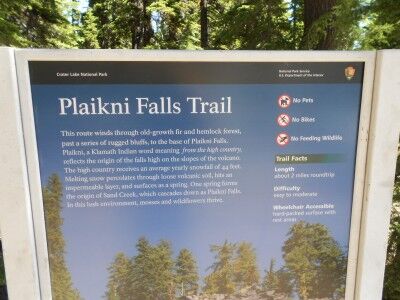
sign at the trailhead of Plaikni Falls trail

Little Colorado River Confluence Grand Canyon National Park Rafting

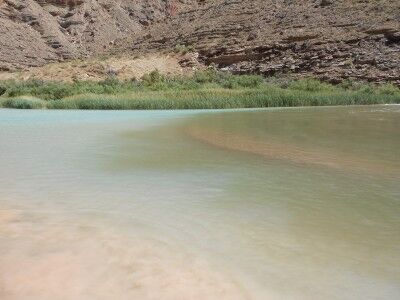
We spent our second night in Grand Canyon National Park along the Colorado River at a campsite called Above Little Colorado River. As its name implies, the campsite was located just upriver from the Little Colorado River. The Little Colorado River has a high alkaline and mineral content which gives the river a beautiful turquoise hue. This can readily be seen at the confluence where the Colorado River and the Little Colorado River meet:

Meeting of the Colorado River and Little Colorado River

It was fascinating watching the color of the two rivers meet and blend together as the color line between the two constantly changed and moved.

Bumpass Hell Trail Lassen Volcanic National Park

I had made a trip to Lassen Volcanic National Park in June to find that most of the park was still closed to snow. Since I was in the general area again on a trip to visit a friend, I decided to make another stop knowing that a lot more of the park would be open.

The main goal I had was to hike to Bumpass Hell since I heard good things about it. It’s never good when you go to the trailhead of the hike you are planning to take and see the following sign:

Bumpass Hell hazardous trail sign Lassen Volcanic National Park

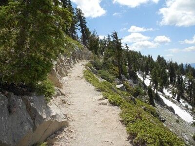
Since starting this blog I have become much more aware of all the deaths that take place in National Parks, many of them due to people doing stupid things that they have been warned not to do. At the same time, there were quite a few people taking the trail so I was torn on what to do. I eventually stopped a couple of hikers that were coming back and asked them how the trail was. They explained that there were still areas of the trail covered in snow and ice that were slippery, but passable if you took your time. I decided to give the trail a try figuring I could turn back if it ended up being too dangerous. In the early going, the trail was clear and it didn’t seem there would be any issue:

Bumpass Hell trail August 2011

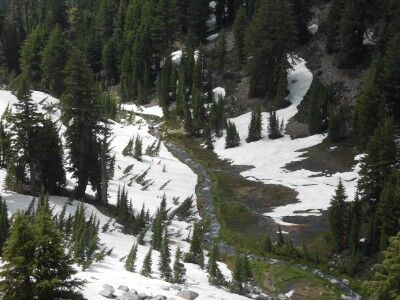
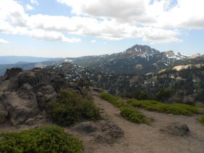
And provided some spectacular views:

view hiking along Bumpass Hell Lassen Volcanic National Park

Diamond Peak from Bumpass Hell trail Lassen Volcanic National Park

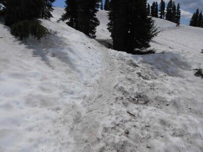
It wasn’t long, however, that the reason for the warning sign became apparent. Despite it being mid August, here were several long stretches of the path that were still completely covered with snow that would have made the path quite difficult for anyone that wasn’t very sure footed:

Bumpass Hell trail covered with snow at Lassen Volcanic National Park

While the trail was definitely passable, there were quite a few people on the trail that were struggling and having to take the trail at an extremely slow pace. This was especially true for those that were in tennis shoes rather than hiking boots and families that had younger children. While the trek would have definitely been a lot easier had all the snow been cleared, it still may be a few weeks until that happens. If you happen to be in the area, I think it is worthwhile making the trek despite the snow — just be sure that you are wearing the proper hiking equipment.