I just can’t imagine how anyone could do this without totally freaking out. 60 Minutes cameras were rolling when Alex Honnold free-solo climbed Sentinel (a 1,600-foot rock wall at Yosemite National Park) using nothing more than his hands and feet. That’s right — he is up there on that rock face without any ropes to complete a feat never done before. Just watching makes me dizzy:
Barker Dam Loop Joshua Tree National Park
The Barker Dam loop trail in Joshua Tree National Park is often suggested for those with children since it is an easy 1.5 mile loop. The trailhead is east to find since it is right at the Barker Dam parking lot. You can also take the spur path off the main loop to see pictographs and petroglyphs and there are plenty of boulders for kids to climb to expel any excess energy they may have.
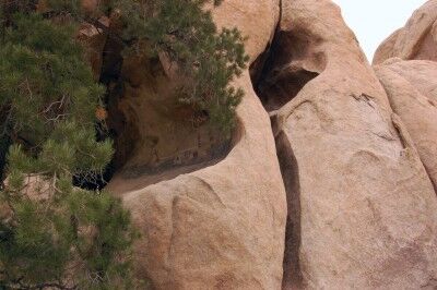
While it is also possible to walk across Barker Dam, this activity is better suited for those that are older and have no fear of thin walking uneven paths with a drop off on either side as this video shows:
Photo courtesy of Omar Omar
Black Bear Cub Opens Car Door Great Smoky Mountains National Park
A good example of why you don’t leave car doors open. A black bear cub manages to pry open a door on a car at Great Smoky Mountains National Park and get inside. While definitely cute, it’s not a habit that young bears should be learning:
From the video information:
While going to our cabin in Great Smoky Mountains National Park, we saw a baby bear cub pry open a barely opened car door and climb in. All of this happening while the mother bear and another bear cub waited a couple feet away. Nobody was in the car while this happened, nobody got hurt, the bear didn’t damage the car, and the bear didn’t get anything unhealthy to eat
Moab Fault Arches National Park
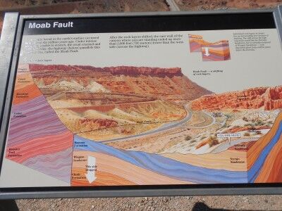
With over 2000 arches at Arches National Park, you might think that arches is all the park has to offer. You would be wrong. The first paved turnout that you will come across once you have entered Arches National Park is one that describes Moab Fault. The pull-out gives a wonderful view of the highway you drove in on to reach Arches which also shows in detail the Moab Fault:
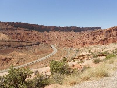
Your instinct will be to pass on by and most cars do, but it’s well worth stopping simply to get a better understanding of how Arches National Park was formed. It will only take 5 minutes of your time and the plentiful arches waiting on the other side of the ridge will still be there. If you think that you will stop on your way back, you may have great intentions of doing so, but the reality is that you likely won’t. The turnout is much easier to see on the way into Arches and by the end of the day of hiking you won’t have the energy to do so.
There is an informational sign at the turnout that gives the following description:
A dramatic break in the earth’s surface occurred here about six million years ago. Under intense pressure, unable to stretch, the crust cracked and shifted. Today, the highway (below) parallels this fracture line, called the Moab Fault.
After rock layers shifted, the east wall of the canyon where you are standing ended up more than 2,600 feet (792 meters) lower than the west side (across the highway).
Individual rock layers no longer line up horizontally here because of the faulting. The cliff across the highway looks much like the Entrada sandstone, but is actually composed of Wingate Sandstone — rock deposited about forty million years before the Entrada.
If the sole purpose of visiting Arches National Park is to see as many arches as you can, then the Moab fault information will be of little interest to you, but if you are there to learn, this five minute pull out is well worth the time.
Pumice Castle Crater Lake National Park
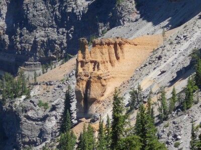
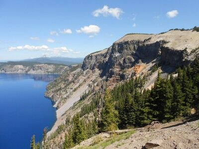
Pumice Castle is one of the most colorful (a golden orange-brown in a sea of grays) features at Crater Lake National Park, but it’s often missed because it’s located at an unmarked turnoff along East Rim Drive (the pullout is 1.1 miles west of Cloudcap Overlook road junction and 2.4 miles east of Phantom Ship Overlook). It’s well worth paying attention and not passing this unique feature within the Crater Lake caldera. The orange-brown pumice rock has emerged in the shape of a castle as the rock around it has eroded away:
This is what the information sign at the turnout has to say about Pumice Castle:
Mount Mazama, the great volcano that preceded Crater Lake, was built up by successive eruptions of lava over many thousands of years. Some lavas oozed or poured from the volcano’s top or sides. Some erupted as red-hot rocks that flooded down the slopes. Others exploded into the air and fell as cinders or globs.
You can see the variety of Mt. Mazama’s lavas on the steep caldera wall. Pumice Castle, with its pinkish-brown “turrets,” is the most eye-catching feature. It’s made of layers of pumice and other rocks coughed up by Mt. Mazama – some so hot they welded welded together. These air fall deposits were buried and compacted by other lavas, then exposed when Mt. Mazama collapsed. A firm foundation of andesite lava has kept Pumice Castle intact, while surrounding pumice deposits have eroded away.
Mt. Mazama is classified as a composite volcano, a cone built up by lava flows interspersed with air fall deposits. Pumice Castle is made of air fall pumice that was laid down while Mt. Mazama was still growing.
Bear Cubs Wrestling at Yosemite National Park
Sprague Lake Fishing Rocky Mountain National Park
One of the things that you’ll immediately notice when hiking around Sprague Lake (besides the beautiful scenery) at Rocky Mountain National Park are the large number of people fishing on the lake. The scenery combined with those fishing can make for some dramatic fishing photos:
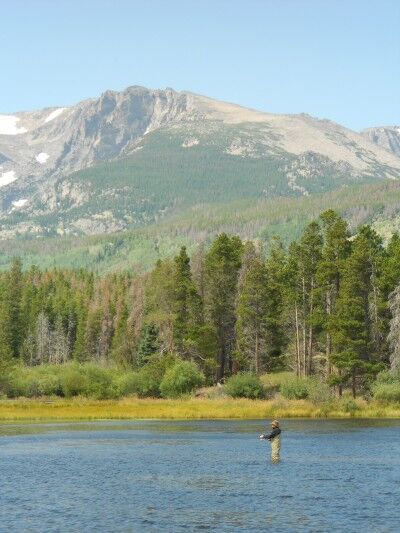
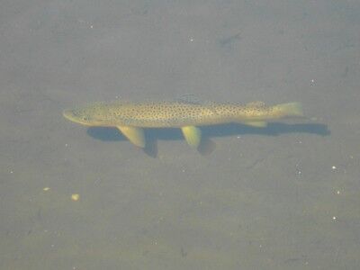
Sprague Lake is the remnant of a resort once owned by Abner Sprague who used to stock the lake for fishermen visiting the resort, so there are plenty of fish in the waters. In fact, simply walking around the edges of the crystal clear water of Sprague Lake will usually allow you to see the fish within:
Discovery Point Crater Lake National Park
I made a couple of previous trips to Crater Lake National Park this year, but due to the heavy snow, could only see park of the park. On the second trip, Rim Drive was open to Discovery Point and I was able to get some photos and a video, but there was still a lot of snow on the ground. This time around, the entire Rim Drive was open and just a very small amount of snow remained in isolated places. I went back to the same spot (which was a lot easier to get to when you didn’t have to hike up a snow covered hill) and took the following photos:
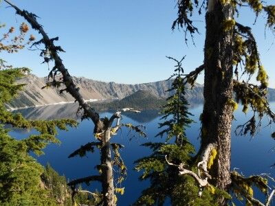
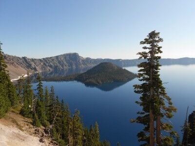
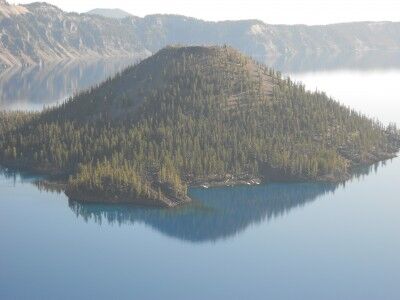
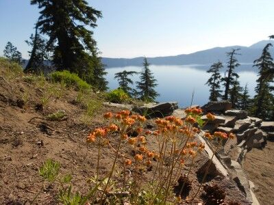
While it really is impossible to stop anywhere along Rim Drive and not get a spectacular view of Crater Lake, Discovery Point is definitely one worth stopping for. There’s a small hill to the left of the parking area with a dirt path up to a higher vantage point — it’s worth doing this short hike if you are physically able to as it gives you views of crater lake among the trees.
This is what the information sign at Discovery Point has to say:
Near this point a plodding mule stopped abruptly a few feet short of the crater rim. Its astonished rider suddenly found himself on the brink of a natural wonder few had ever seen, John Wesley Hillman had stumbled upon Crater Lake.
The day was June 12, 1853. Hillman had joined a party of goldseekers on a search for the fabled Lost Cabin Mine. They found no gold, but they knew they had discovered a scenic treasure. The prospectors erected a crude sign bearing their signatures and named the the majestic waters “Deep Blue Lake.”
In the years that followed, the lake was rediscovered and renamed several times. An 1869 exploring party gave the lake its present name and in 1902, Crater Lake became the nation’s sixth national park.
Puzzle Rocks Lassen Volcanic National Park
There is a 0.5 mile loop trail at the Devastated Area at Lassen Volcanic National Park (CA) appropriately named the Devastated Area Trail. The trail is an easy hike with a number of information signs teaching about the rocks left behind from Lassen Peak’s 1915 eruption. One of the most interesting of these I found were the puzzle rocks which had the following description sign by them:
After the May 19 avalanche carried hot lava rocks, the surrounding air temperature quickly cooled them. As they cooled — from the outside in — some of the rocks fractured internally, breaking into pyramid-like shapes. Like a jigsaw puzzle, many of the pieces could easily be reconfigured — solving a hot puzzle from the past…
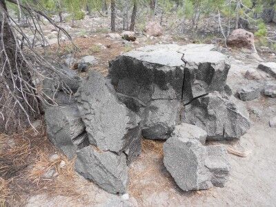
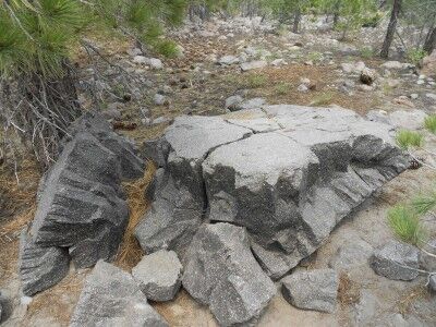
As the description indicates and the photos show, these rocks really do look like puzzles that could easily be shaped back together with a bit of effort. I always enjoy finding tidbits of information like this when I travel to the various National Parks.
Sprague Lake Hike Rocky Mountain National Park
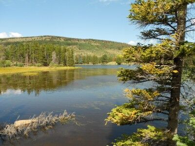
The Sprague Lake Hike at Rocky Mountain National Park is an easy half mile loop around Sprague Lake at an elevation of 8,970 feet. The lake is actually the remnant of a resort once owned by Abner Sprague (where it gets its name) which he dammed in 1915 to make it about 13 acres. The trail is mostly dirt, but it’s level and wheelchair accessible with boardwalks along the trail where needed:
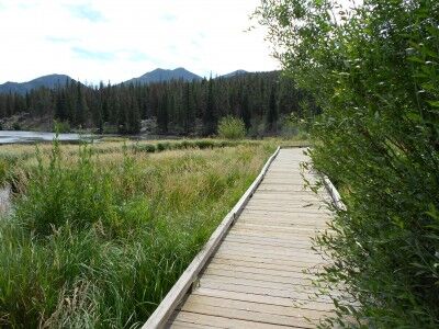
The hike provides numerous beautiful views of both the lake
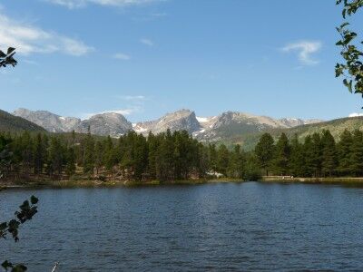
and the surrounding mountains, including many peaks which make up the Continental Divide:
It’s a wonderful place to take kids on an easy walk to see the outdoors. The lake is shallow with a large number of fish which can sometimes be seen from the lake’s bank (and there are plenty of fishermen around the lake as well).
