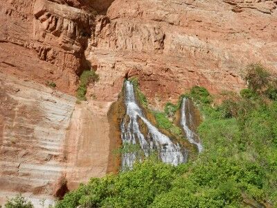
Plaikni Falls Trail Crater Lake National Park

Crater Lake National Park has a new hiking trail that will officially be opening this Saturday (8/20/2011), but I had the fortunate chance to hike it today. It’s called Plaikni Falls Trail and it’s a wonderful change of beauty from what most people only see when they visit Crater Lake National Park — the lake. The Plaikni Falls Trail leads to a gorgeous “secret” waterfall and cascading river which, until recently, few people knew how to get to.

The trailhead is along Pinnacle Road, 1.2 miles southeast of the Phantom Ship overlook off of East Rim Drive. The trail begins with old growth fir and hemlock forest all around which provide a nice bit of shade:
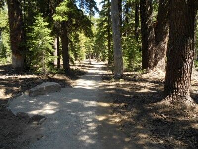
Plaikni Falls Trail at Crater Lake National Park

Plaikni Falls trail is a pleasant hike and relatively easy at 1.1 miles to the waterfall (2.2 miles round trip). The only real issue for most is that because it’s so short, it’s difficult to get away from other people if you’re looking for a bit of solitude — it can get congested. The trail travels through the trees and along rocky bluffs until it hits Sand Creek where it opens up to wildflowers and lush vegetation at the base of Plaikni Falls:
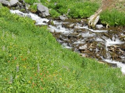
wildflowers at Plaikni Falls at Crater Lake National Park

While Plaikni Falls isn’t grand in size, it’s quite beautiful as it comes down with abundant wildflowers (with butterflies fluttering all around while I was there — also mosquitoes, so you may want to spay on some bug spray before beginning the hike) and other vegetation to compliment the overall scene:
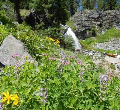
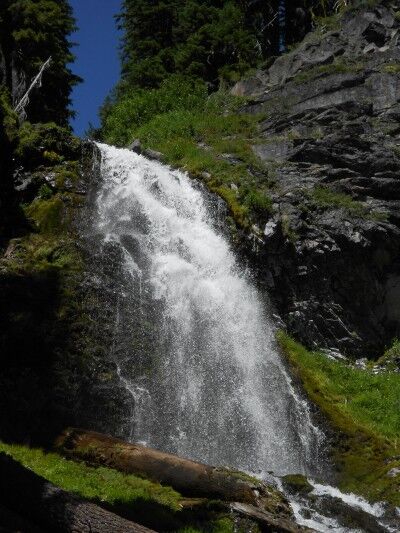
Plaikni Falls with wildflowers at Crater Lake National Park

Plaikni Waterfall at Crater Lake National Park

I would highly recommend this hike for those looking to see a different type of beauty other than the lake when visiting Crater Lake, especially for people like me who have a thing for waterfalls.

Note: This may not be an issue once the trail has officially opened, but it would have been today. While the trail is supposed to be a hard packed surface suitable for wheelchairs and strollers, not enough people had traveled the trail to make the hard-pack hard. A wheelchair or stroller would have definitely had some trouble getting to the falls when I went. This issue may very well be resolved by Saturday for the official opening. There were still volunteers hard at work finishing up the last touches on the trail, so they are aware that there is still work to be done.
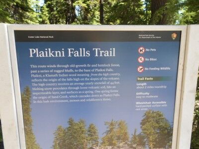
sign at the trailhead of Plaikni Falls trail

Little Colorado River Confluence Grand Canyon National Park Rafting

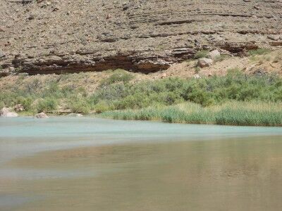
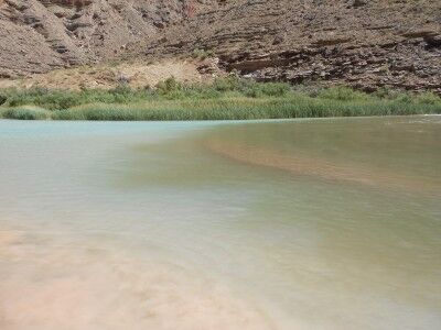
We spent our second night in Grand Canyon National Park along the Colorado River at a campsite called Above Little Colorado River. As its name implies, the campsite was located just upriver from the Little Colorado River. The Little Colorado River has a high alkaline and mineral content which gives the river a beautiful turquoise hue. This can readily be seen at the confluence where the Colorado River and the Little Colorado River meet:

Meeting of the Colorado River and Little Colorado River

It was fascinating watching the color of the two rivers meet and blend together as the color line between the two constantly changed and moved.

Bumpass Hell Trail Lassen Volcanic National Park

I had made a trip to Lassen Volcanic National Park in June to find that most of the park was still closed to snow. Since I was in the general area again on a trip to visit a friend, I decided to make another stop knowing that a lot more of the park would be open.

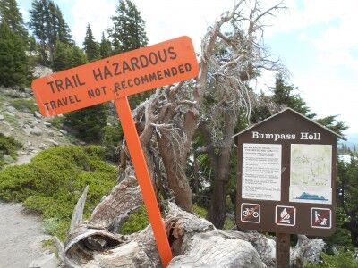
The main goal I had was to hike to Bumpass Hell since I heard good things about it. It’s never good when you go to the trailhead of the hike you are planning to take and see the following sign:

Bumpass Hell hazardous trail sign Lassen Volcanic National Park

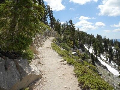
Since starting this blog I have become much more aware of all the deaths that take place in National Parks, many of them due to people doing stupid things that they have been warned not to do. At the same time, there were quite a few people taking the trail so I was torn on what to do. I eventually stopped a couple of hikers that were coming back and asked them how the trail was. They explained that there were still areas of the trail covered in snow and ice that were slippery, but passable if you took your time. I decided to give the trail a try figuring I could turn back if it ended up being too dangerous. In the early going, the trail was clear and it didn’t seem there would be any issue:

Bumpass Hell trail August 2011

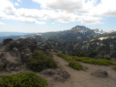
And provided some spectacular views:

view hiking along Bumpass Hell Lassen Volcanic National Park

Diamond Peak from Bumpass Hell trail Lassen Volcanic National Park

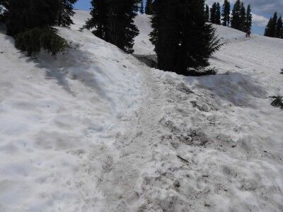
It wasn’t long, however, that the reason for the warning sign became apparent. Despite it being mid August, here were several long stretches of the path that were still completely covered with snow that would have made the path quite difficult for anyone that wasn’t very sure footed:

Bumpass Hell trail covered with snow at Lassen Volcanic National Park

While the trail was definitely passable, there were quite a few people on the trail that were struggling and having to take the trail at an extremely slow pace. This was especially true for those that were in tennis shoes rather than hiking boots and families that had younger children. While the trek would have definitely been a lot easier had all the snow been cleared, it still may be a few weeks until that happens. If you happen to be in the area, I think it is worthwhile making the trek despite the snow — just be sure that you are wearing the proper hiking equipment.

National Parks By State List

the emblem of the National Park Service

The very first post I made on this blog was a list of National Parks in alphabetical order. I recently received an email asking if I had a list of the National Parks by state, and since I didn’t, I decided that it was time to place one on this blog. Only half of the states have at least one National Park (plus the Virgin Islands). Of those 25 states that do have a National Park, 13 only have one National Park while the other 12 have multiple National Parks. Here is a list of National Parks by state:

Alaska National Parks

Denali National Park
Gates of the Arctic National Park
Glacier Bay National Park
Katmai National Park
Kenai Fjords National Park
Lake Clark National Park
Wrangell-St. Elias National Park

Arkansas National Parks

Hot Springs National Park

Arizona National Parks

Grand Canyon National Park
Petrified Forest National Park
Saguaro National Park

California National Parks

Channel Islands National Park
Death Valley National Park
Joshua Tree National Park
Lassen Volcanic National Park
Redwood National Park
Sequoia and Kings Canyon National Park
Yosemite National Park

Colorado National Parks

Black Canyon of the Gunnison National Park
Great Sand Dunes National Park
Mesa Verde National Park
Rocky Mountain National Park

Florida National Parks

Biscayne National Park
Dry Tortugas National Park
Everglades National Park

Hawaii National Parks

Haleakala National Park
Hawaii Volcanoes National Park

Idaho National Parks

Yellowstone National Park

Kentucky National Parks

Mammoth Cave National Park

Maine National Parks

Acadia National Park

Michigan National Parks

Isle Royale National Park

Minnesota National Parks

Voyageurs National Park

Montana National Parks

Glacier National Park

North Carolina National Parks

Great Smoky Mountains National Park

North Dakota National Parks

Theodore Roosevelt National Park

Nevada National Parks

Great Basin National Park

Ohio National Parks

Cuyahoga Valley National Park

Oregon National Parks

Crater Lake National Park

South Carolina National Parks

Congaree National Park

South Dakota National Parks

Badlands National Park
Wind Cave National Park

Texas National Parks

Big Bend National Park
Guadalupe Mountains National Park

Utah National Parks

Arches National Park
Bryce Canyon National Park
Canyonlands National Park
Capitol Reef National Park
Zion National Park

Virginia National Parks

Shenandoah National Park

Virgin Islands National Parks

Virgin Islands National Park

Washington National Parks

Mount Rainier National Park
North Cascades National Park
Olympic National Park

Wyoming National Parks

Grand Teton National Park
Yellowstone National Park

Lake Helen Lassen Volcanic National Park

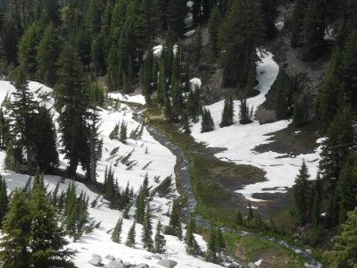
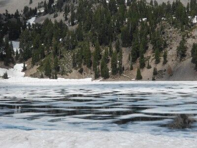
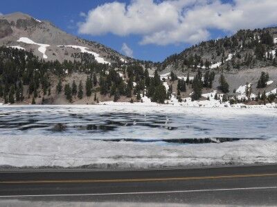
Lake Helen at Lassen Volcanic National Park, much like Emerald Lake (which is just below it), is still covered with a thin sheet of ice even though it’s the middle of August. In fact, it has quite a bit more ice than Emerald Lake:

Lake Helen at Lassen Volcanic national Park

ice covered Lake Helen at Lassen Volcanic National Park

Lake Helen can be seen both from the Main Park Road and while on Bumpass Pass trail, but with all the snow it was a bit too dangerous for me to go down to the lake edge (there are a lot of “thin ice” hazard warning signs all around) since in many areas it’s difficult to tell where the snow on the ground ends and the thin lake ice begins. I’m sure this is another beautiful lake with crystal clear water that delivers a magnificent reflective photo opportunity when all the snow is gone and the sky is blue and I hope I get a chance to get back in the near future to see it this way as well.

Emerald Lake Lassen Volcanic National Park

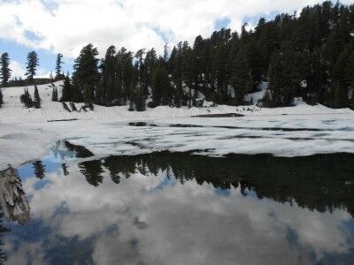
Being August, I knew that Lassen Volcanic National Park would be much more snow free than it was on my last visit. Even so, the park was definitely not snow free. Driving Main Park Road, I reached Emerald Lake to find that half the lake still had a sheet of thin ice covering it:

Emerald Lake covered with ice at Lassen Volcanic National Park

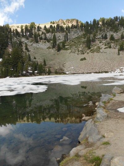
I’m sure that when Emerald Lake is free of ice and it’s a clear day, the reflection in it is absolutely beautiful. I was able to get a small glimpse of this on the side that was somewhat free of ice:

reflection in Emerald Lake at Lassen Volcanic National Park

Rock Slide Grand Canyon National Park Rafting

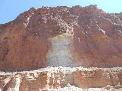
One of the most interesting things I learned while river rafting down the Colorado River in Grand Canyon National Park is that much of the Grand Canyon sandstone isn’t originally red. When you look from the rim of the Grand Canyon down toward the river and see the huge expanse of red sandstone walls, it isn’t difficult to assume that all that color is the original color of the canyon walls. In reality, much of the lower Grand Canyon walls that are red in appearance have simply been stained on the outside by upper layers of the canyon that are red. A perfect illustration of this is the scar left by a recent rock slide within the Grand Canyon we came across after leaving Redwall Cavern:

Grand Canyon rock slide Colorado River rafting

As the rock slide shows, the color of the rock is actually white and not the red of the surrounding rock that has been stained over time. Of course, this newly exposed rock will also eventually get stained to the red we all associate with the Grand Canyon, but I found it interesting to consider what impressions we would all have of the Grand Canyon if it were mostly white instead of red…

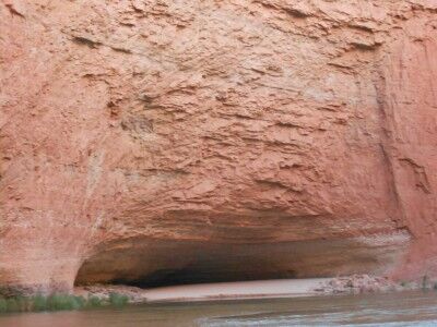
Redwall Cavern Grand Canyon National Park Rafting

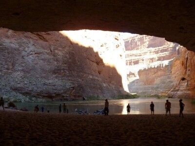
Located between mile 33 and 34 along the Colorado River in Grand Canyon National Park (and just over a mile downriver from Vasey’s Paradise) Redwall Cavern is a giant symphony-sized amphitheater created by the river eroding away the limestone Grand Canyon walls. John Wesley Powell, upon seeing Redwall Cavern, guessed that 50,000 people would fit into it. Although it would be a perfect place to camp, it’s one of the sandbars along the Colorado River where it’s prohibited to camp or build fires.

Redwall Cavern Colorado River rafting

When you land at Redwall Cavern, you will immediately see the fresh feet and tail tracks of countless lizards and other small animals that make their home within the cavern. The wide open space in the shade makes for a perfect place to take out a football or Frisbee to toss around with friends, and it’s a must to walk to the back of the cavern to touch the far wall (this gives you a good perspective on how big Redwall Cavern really is).

Redwall Cavern looking onto the Colorado River
Photo courtesy of Angela Saurine escape.com.au

If you look closely at the rocks toward the front left (when looking out at the river) of Redwall Cavern, you should be able to spot fossils within them. Our guide showed us some and then I spent about half an hour looking at the rocks and found numerous other fossils within the rocks there.

Monitoring Glaciers at Mount Rainier National Park

In the continuing series of videos I have been posting about National Park science (Restoring Native Prairies, Black Bear Science and Tidepool Science), the latest science video talks about monitoring glaciers at Mount Ranier National Park and the three main reasons that it is done:

1. To monitor changing habitats for species and the alpine food web.
2. To monitor for indicators of climate change.
3. To monitor water levels.

The scientists visit at least twice a year to monitor the amount of snow that has accumulated and then how much melt has occurred. This has shown that there has been a decrease of the glacier area of more than 50% in the last century:

National Park Service scientists have been monitoring glaciers at Mount Rainier, North Cascades, and Olympic national parks to document their rates of growth and decline. Not only are glaciers awe-inspiring elemental forces, but they are absolutely critical resources for northwest ecosystems and for human populations. Glaciers are also the clearest evidence of climate change. Measuring glaciers is not for the faint of heart. Besides snow, ice, blasting winds, and crevasses, the necessary equipment is heavy and the distances on foot are long and go up steeply. This video features the people who do this tough work.

Vasey’s Paradise Grand Canyon National Park Rafting

While it’s possible to hike to Vasey’s Paradise (also called Vaseys Paradise) from Stanton’s cave (only about 1/4 of a mile further away), I chose not to do so. There is thick vegetation at the bottom of Vasey’s Paradise includes the one area in Grand Canyon National Park where poison ivy is abundant, and getting poison ivy was not how I wanted to spend my grand canyon rafting trip. It’s also where the critically endangered Kanab Ambersnail lives.

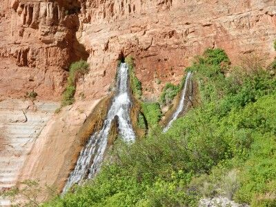
Vasey’s Paradise is the first waterfall on the Colorado River rafting trip which flows year round (there are plenty of waterfalls along the river that are active during flash floods, but quickly dry up). Vasey’s Paradise was named after a botanist who travelled with Powell surveying the river in 1868. The waterfall gets its water from rain that seeps through the upper sandstone layers of the canyon until it hits harder rock where it gathers. It flows out from the upper cliff faces from two cave holes in the canyon wall.

Vasey's Paradise waterfall

This is the first oasis that is seen from the river on the rafting trip, but for the aforementioned reason, isn’t a place where rafts usually stop to explore. It does make for a wonderful contrast to the desert environment as you float past it down the river.

Vaseys Paradise waterfall from Colorado River