Devil’s Kitchen Trail Colorado National Monument

By Kristen Lummis (enjoy her blog Brave Ski Mom, like her on facebook or follow her on twitter @BraveSkiMom)

My city-girl niece visited us this summer. She lives in the Denver area and we live on Colorado’s Western Slope. She is 8 years old, full of energy and loves to be outdoors. I am much older, but still full of energy. And, I too, love to be outdoors. We are a good match.

So on a cool Saturday, despite the threat of rain, my mom and I took her hiking at Colorado National Monument. Here is our report from the Devil’s Kitchen Trail.

Lots of Prickly Pear Blossoms: I am mom to two boys. Thus, I am used to spotting lizards, oohing and ahhing over rocks, and identifying unique shapes and uses for twigs and sticks. My niece pointed out the brilliant cactus blossoms and spotted lizards. Rocks and sticks, not so much.
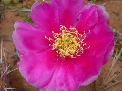
Prickly Pear Blossom at Colorado national Monument

Plenty of Room to Run: And run she did. She ran, she climbed, she skipped and she balanced. An open trail, a beautiful day and nothing to do but enjoy being amidst the splendor of nature.
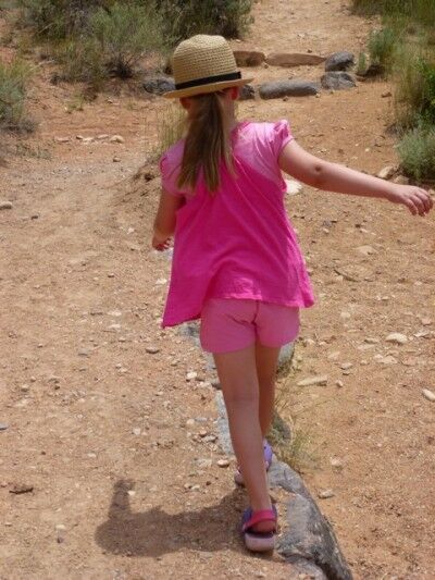
balancing on devil'skitchen trail at Colorado national monument

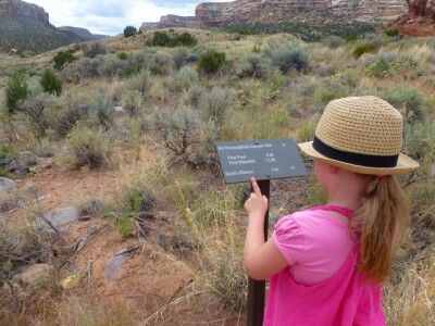
Time to Practice Trail Boss Skills: My niece is the youngest in her family. We let her choose the trail, set the pace, lead the way, and read the signs. We helped her find the cairns marking the trail and she became our official cairn-spotter. She was an excellent trail boss.
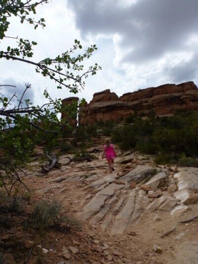
trail boss on Devil's Kitchen trail

While hiking with her, I was reminded of an article I recently read entitled Leave No Child Inside. Concerned about the trend of more and more kids spending their days indoors looking at TV and computer screens, a group of outdoor agencies and advocates in Chicago are urging families to turn off the technology and get outside. As one of the organizers put, “(Children) are excited to be outdoors.”

That is so true. No matter where you live, kids are excited to be outdoors. Some time in the sunshine, lying in the grass, hiking on a trail or chasing butterflies is exactly what our kids need.

No matter where you live, you can find the great outdoors. It’s just a matter of opening the door and walking outside: to an urban park, to a meadow, to a national monument, to wherever you can find nature.

When You Go: 2011 is a great year to get out and visit Colorado National Monument. Located near Grand Junction, approximately 250 miles west of Denver on I-70, the Monument is celebrating its 100th Anniversary as a unit of the National Park System with fireworks, special events and new displays in the Visitors’ Center.

Hiking: Comprised of 32 square miles of stunning red rock canyons and monoliths between Grand Junction and Fruita, Colorado National Monument has miles and miles of established and back country trails.

My niece, my mom and I chose the Devil’s Kitchen trail for our adventure. 1 and 1/2 miles long, the trail begins on sandy, clearly marked trail and after about 1/2-mile transitions to sandstone and slickrock.

devil's kitchen trail Colorado national monument

Climbing and switch-backing across slickrock, the trail offers enough adventure to keep kids engaged and ends in the Devil’s Kitchen, a sandstone “room” hundreds of feet above the valley. With rocks to climb on and ledges to peer over, kids can keep themselves busy in the Kitchen for hours.
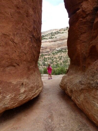
hiking devil's kitchen Colorado national monument

Camping: Camping is available at the Saddlehorn Campground, along the upper rim of the canyons in the pinyon and juniper forest. There are no hookups for RVs, but there are flush toilets and running water, which in my mind, changes the experience from camping to glamping. Sites are available on a first-come, first-served basis.

Finally, if you’ve ever wondered why some National Park sites are called Parks and some are called Monuments, here’s your answer: Parks require the approval of Congress. Monuments do not.

In 1911, with feelings in Congress running against conservation, Colorado officials didn’t think they had the votes necessary to create a national park. In May of that year, President Taft preserved this glorious slice of canyon country with the stroke of his pen.

Enjoy!
Pumice Castle Crater Lake National Park

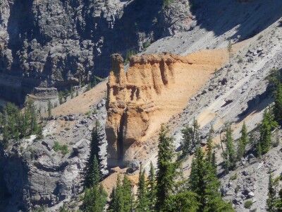
Pumice Castle is one of the most colorful (a golden orange-brown in a sea of grays) features at Crater Lake National Park, but it’s often missed because it’s located at an unmarked turnoff along East Rim Drive (the pullout is 1.1 miles west of Cloudcap Overlook road junction and 2.4 miles east of Phantom Ship Overlook). It’s well worth paying attention and not passing this unique feature within the Crater Lake caldera. The orange-brown pumice rock has emerged in the shape of a castle as the rock around it has eroded away:

Pumice Castle at Crater Lake

Pumice Castle at Crater Lake National Park

This is what the information sign at the turnout has to say about Pumice Castle:

Mount Mazama, the great volcano that preceded Crater Lake, was built up by successive eruptions of lava over many thousands of years. Some lavas oozed or poured from the volcano’s top or sides. Some erupted as red-hot rocks that flooded down the slopes. Others exploded into the air and fell as cinders or globs.

You can see the variety of Mt. Mazama’s lavas on the steep caldera wall. Pumice Castle, with its pinkish-brown “turrets,” is the most eye-catching feature. It’s made of layers of pumice and other rocks coughed up by Mt. Mazama – some so hot they welded welded together. These air fall deposits were buried and compacted by other lavas, then exposed when Mt. Mazama collapsed. A firm foundation of andesite lava has kept Pumice Castle intact, while surrounding pumice deposits have eroded away.

Mt. Mazama is classified as a composite volcano, a cone built up by lava flows interspersed with air fall deposits. Pumice Castle is made of air fall pumice that was laid down while Mt. Mazama was still growing.

Bear Cubs Wrestling at Yosemite National Park

In July 2011, hikers returning from a hike in Hetch Hetchy suddenly stumbled on two bear cubs in the middle of the road and their mother off to the side. The caught the action on video:

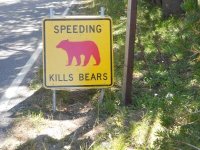
While seeing bears is not a usual occurrence at Yosemite, there is always the possibility as the road signs warn:

speeding kills bears sign Yosemite national park

Observation Point Goblin Valley Utah State Park

Sometime when I’m traveling, I come across a name of a park that is so intriguing that I have to go there even without knowing what I’m going to find. That was the case when I saw Goblin Valley Utah State Park on the map. I can honestly say that this was one of the best decisions I have made. If you have never visited Goblin Valley, it’s one of those places that you want to add to your bucket list.

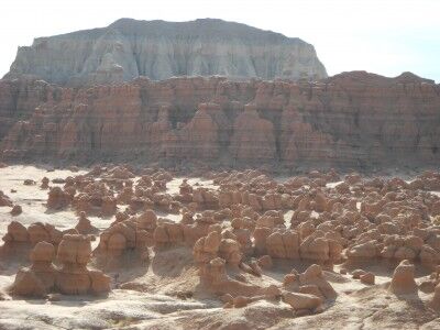
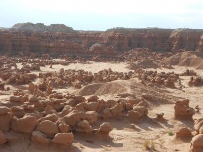
When you first enter Goblin Valley state park, the first recognizable formation you will see are the three goblins. While the three goblins give the impression that the valley will be filled with sparse, distinct goblin formations, you immediately realise this is not the case when you reach Observation Point. Observations Point gives you a wonderful view of Valley 1 (there are actually three valleys) and the hundreds of “goblins” that live within the valley:

observation point Goblin Valley state park Utah

Goblin Valley from Observation Point in Utah

In addition to giving you an amazing first view of Goblin Valley, Observation Point also becomes an essential orientating landmark when you venture down into the valley to look at all the goblins up-close. The point has a large picnic structure with roof that can easily be seen from most places in the valley which keeps one from getting lost in the maze of all the goblins and gives you the security of being a bit more adventurous in your exploration that you might be without this landmark.

Chessman Ridge Overlook Cedar Breaks National Monument

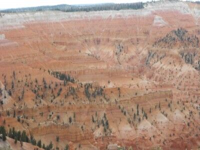
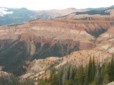
To get the best overall view of Cedar Breaks National Monument, Chessman Ridge Overlook is the place to go. The overlook is directly in the center of the two main areas of the monument. To the left is the Amphitheater:

the Amphitheater at Cedar Breaks national monument

and to the right is Cedar Breaks:

Cedar Breaks at Cedar Breaks National Monument

There is a very short walk from the parking lot to the overlook which is wheelchair accessible. The overlook gives a wonderful perspective of the entire park where you can step back and see the vastness, or focus in on specific points to see the intricate details of the weathered rocks. A poem from the Cedar Breaks national Monument newsletter does a nice job summing everything up:

Clinging to the clouds at 10.350 feet
Cracks and crevasses, hoodoos and arches

Exposed limestone structures from the ancient amphitheater.
Elegant and profuse, wildflowers appear in July

Brushing the sub-alpine meadows in a rainbow of colors.
Bristle Cone Pine, twisted, stunted, ancient trees

Remain standing in drought and flood for over 1,600 years.
Raptors, ravens, California Condors soar and play on warm updrafts.

Nighttime approaches, campfires flicker, Rangers tell stories.
Night sky deepens, dark, vast. The stars appear.

Millions of stars, billions of stars, stars no longer hidden by city lights.
Monuments all. The great masterpieces of nature.

This is CEdar BReaks National Monument! — Park Ranger Teri Saa

Sprague Lake Fishing Rocky Mountain National Park

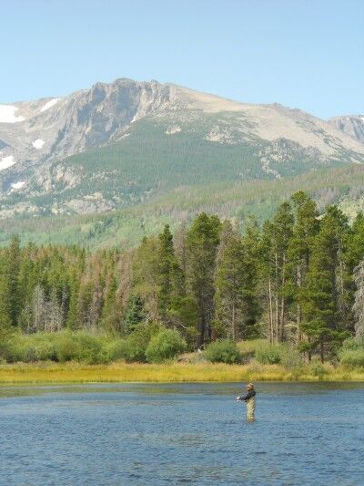
One of the things that you’ll immediately notice when hiking around Sprague Lake (besides the beautiful scenery) at Rocky Mountain National Park are the large number of people fishing on the lake. The scenery combined with those fishing can make for some dramatic fishing photos:

fishing in Sprague Lake at Rocky Mountain National Park

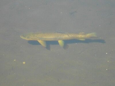
Sprague Lake is the remnant of a resort once owned by Abner Sprague who used to stock the lake for fishermen visiting the resort, so there are plenty of fish in the waters. In fact, simply walking around the edges of the crystal clear water of Sprague Lake will usually allow you to see the fish within:

fish can be seen from the banks of Sprague Lake at Rocky Mountain National Park

Red Canyon Overlook Colorado National Monument

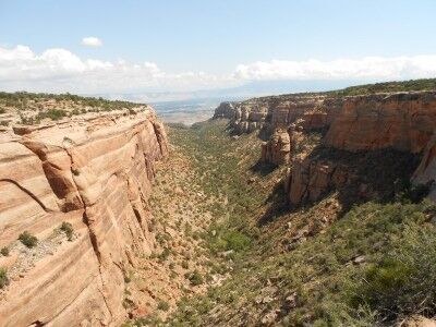
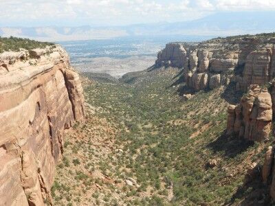
Next to Columbus Canyon (which can be seen from Cold Shivers Point) at Colorado National Monument is Red Canyon. You can get a wonderful view of Red Canyon from Red Canyon Overlook:

Red Canyon at Colorado National Monument

view of the double canyon at Red Canyon in Colorado National Monument

Red Canyon is also interesting because it is actually a canyon within a canyon. It’s described as such at the information sign overlooking the canyon:

Canyon in a Canyon

Red Canyon is really two canyons. Most obvious is the broad U-shaped canyon with the tall sandstone walls. But notice the smaller V-shaped cut in the middle of the canyon floor. Water has begun to carve into the hard metamorphic bedrock, but this old, pressure-treated and tempered rock wears away much more slowly than the fragile sedimentary canyon walls. By the time the small canyon reaches the depth of the large one, all of the sedimentary layers above it will probably be gone.

Discovery Point Crater Lake National Park

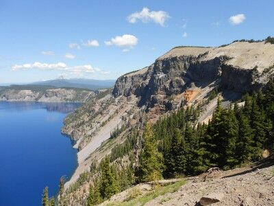
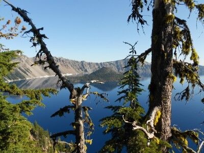
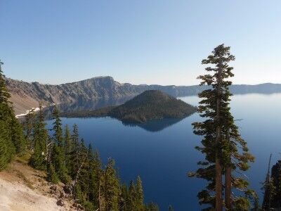
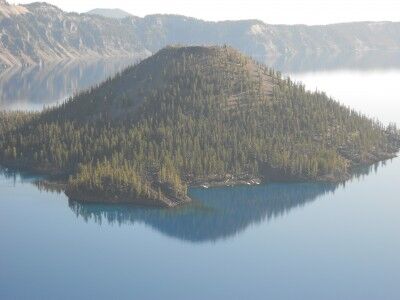
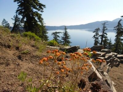
I made a couple of previous trips to Crater Lake National Park this year, but due to the heavy snow, could only see park of the park. On the second trip, Rim Drive was open to Discovery Point and I was able to get some photos and a video, but there was still a lot of snow on the ground. This time around, the entire Rim Drive was open and just a very small amount of snow remained in isolated places. I went back to the same spot (which was a lot easier to get to when you didn’t have to hike up a snow covered hill) and took the following photos:

Discovery Point at Crater Lake National Park

view of Crater Lake at Discovery Point

view of Wizard Island at Discovery Point

Discovery Point wildflowers at Crater Lake National Park

While it really is impossible to stop anywhere along Rim Drive and not get a spectacular view of Crater Lake, Discovery Point is definitely one worth stopping for. There’s a small hill to the left of the parking area with a dirt path up to a higher vantage point — it’s worth doing this short hike if you are physically able to as it gives you views of crater lake among the trees.

This is what the information sign at Discovery Point has to say:

Near this point a plodding mule stopped abruptly a few feet short of the crater rim. Its astonished rider suddenly found himself on the brink of a natural wonder few had ever seen, John Wesley Hillman had stumbled upon Crater Lake.

The day was June 12, 1853. Hillman had joined a party of goldseekers on a search for the fabled Lost Cabin Mine. They found no gold, but they knew they had discovered a scenic treasure. The prospectors erected a crude sign bearing their signatures and named the the majestic waters “Deep Blue Lake.”

In the years that followed, the lake was rediscovered and renamed several times. An 1869 exploring party gave the lake its present name and in 1902, Crater Lake became the nation’s sixth national park.

Puzzle Rocks Lassen Volcanic National Park

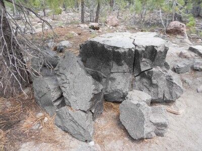
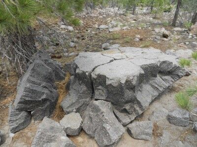
There is a 0.5 mile loop trail at the Devastated Area at Lassen Volcanic National Park (CA) appropriately named the Devastated Area Trail. The trail is an easy hike with a number of information signs teaching about the rocks left behind from Lassen Peak’s 1915 eruption. One of the most interesting of these I found were the puzzle rocks which had the following description sign by them:

After the May 19 avalanche carried hot lava rocks, the surrounding air temperature quickly cooled them. As they cooled — from the outside in — some of the rocks fractured internally, breaking into pyramid-like shapes. Like a jigsaw puzzle, many of the pieces could easily be reconfigured — solving a hot puzzle from the past…

Puzzle Rock Lassen National Park

Puzzle Rocks at Lassen Volcanic National Park

As the description indicates and the photos show, these rocks really do look like puzzles that could easily be shaped back together with a bit of effort. I always enjoy finding tidbits of information like this when I travel to the various National Parks.

Three Goblins: Goblin Valley Utah State Park

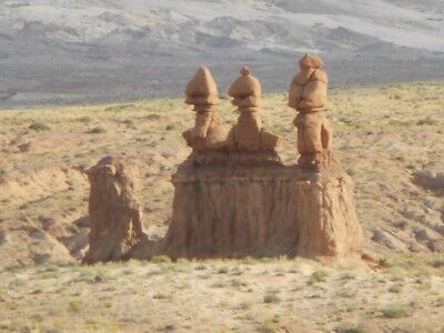
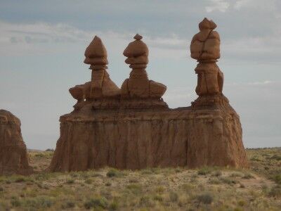
One of the first formations you come upon once you enter Goblin Valley State Park in Utah are the three goblin guards. The three goblin guards stand by themselves off to the left of the road as you drive toward Observation Point. The three stand out because they are the only goblins in the general area and seem to be welcoming you to their little world (or there to warn all the other goblins of your presence).

The three goblins at the entrance of Goblin Valley Utah State Park

The 3 goblins at the entrance of Goblin Valley state park in Utah

The three goblin guards are also deceiving in foretelling what you are about to see once you reach Goblin Valley. They make it appear that you will be entering a world where there will be many distinct formations in their own area, when in reality you’ll soon be seeing hundreds of goblins scattered all over the valley floor.